Berkshire 26er
Are you ready to experience the full summit profile of western Massachusetts? The Berkshire 26er is the ultimate peak-bagging challenge designed for hikers who want to dig deeper into the rugged geography, diverse forest ecosystems, and hidden history of the Berkshire Hills. While thousands of hikers rush through Massachusetts every year on a singular path, this custom-curated circuit requires you to slow down, explore the ridgelines from multiple angles, and step off the beaten track. From the iconic windswept crown of the state high point to the remote, moss-draped sanctuaries of the deep southern valleys, the Berkshire 26er will test your endurance, sharpen your navigation, and reveal the absolute best vistas in the region. Dust off your boots, track your summits, and claim your exclusive Berkshire 26er finisher patch and sticker to commemorate your achievement!


Challenge Highlights
Total Distance: Approximately 115-130 miles of total trail mileage, depending on your choice of loops, approach trailheads, and point-to-point shuttle configurations.
Total Vertical Gain: Roughly 21,000 to 24,000 feet of cumulative elevation gain, serving up everything from gentle rolling hills to grueling 25% grades.
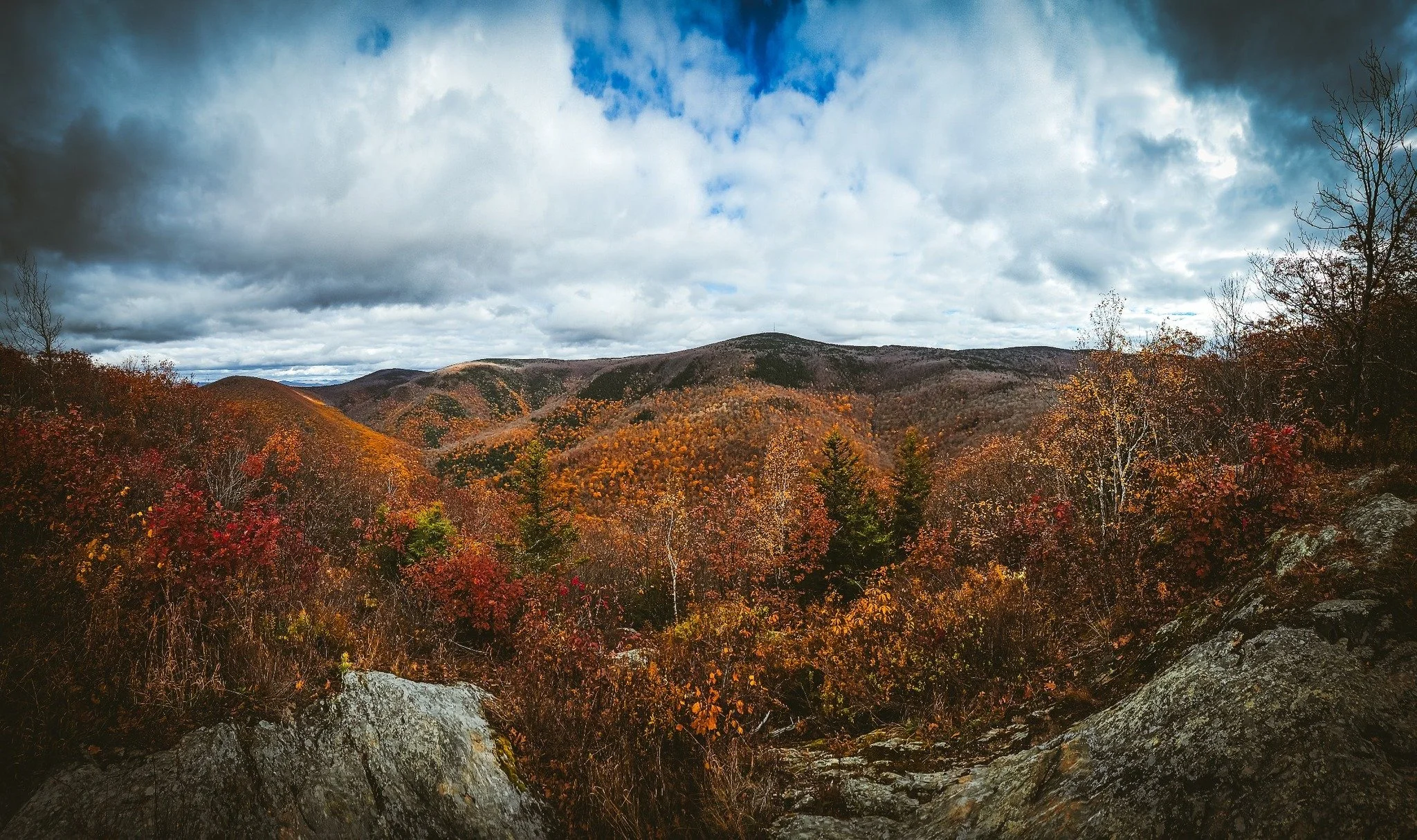
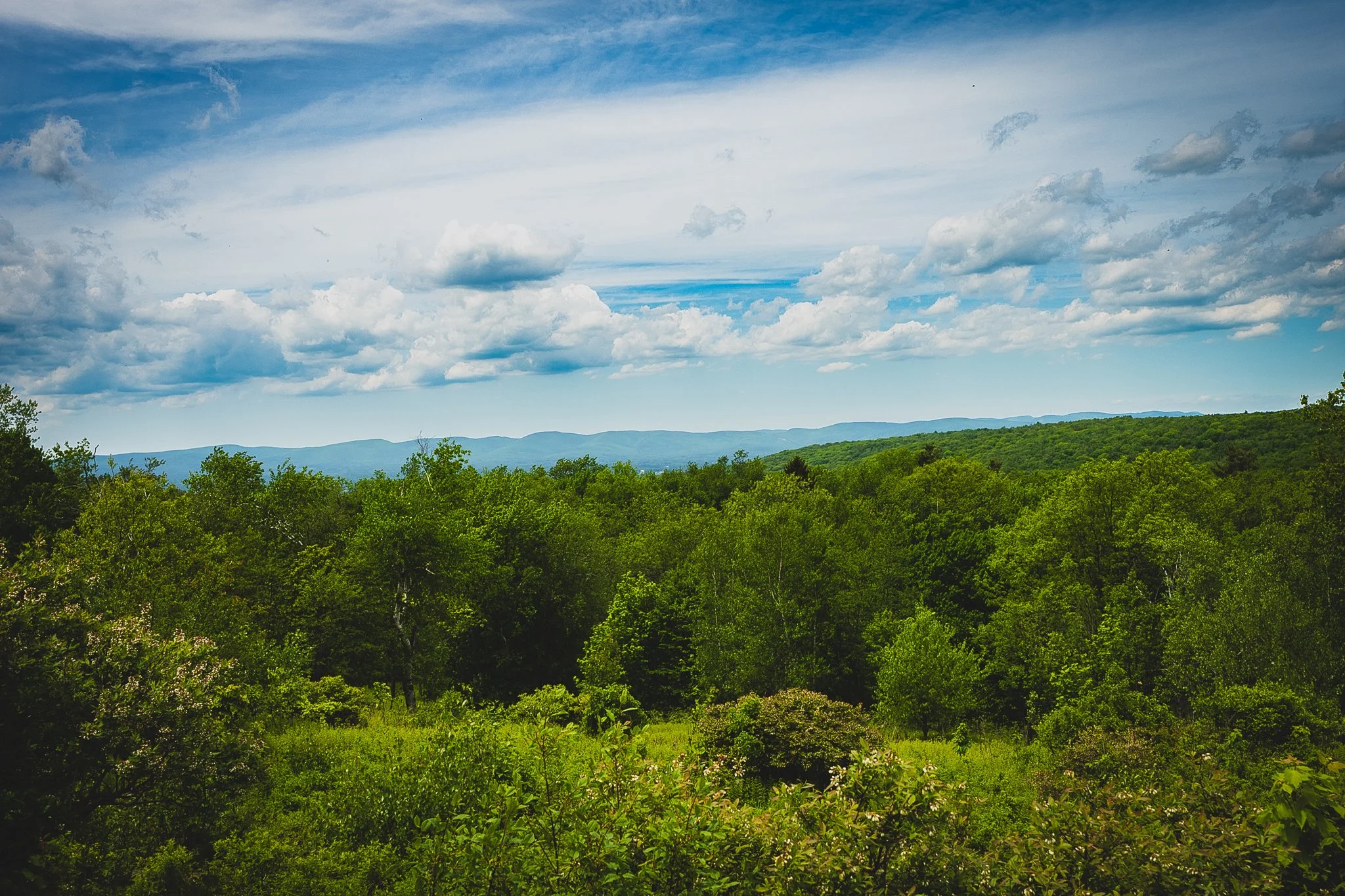
The Crown Jewel: Climbing Mount Greylock (3,491 ft), the iconic state high point of Massachusetts, featuring 90-mile views spanning five states.
The AT Core: Inclusion of 22 peaks directly along the Appalachian Trail, taking you past remote wilderness shelters, high-altitude spruce-fir forests, and historic mountain passes.
Beyond the White Blazes: Inclusion of 4 additional peaks of interest, specifically selected to make this challenge stand out from standard AT thru-hikes. These off-AT spurs—Pine Cobble, Stony Ledge, Spruce Hill, and Ragged Mountain—divert you to the most spectacular amphitheaters, unique quartzite geology, and historic side trails the state has to offer.
The Finish: Earn an exclusive, high-quality Berkshire 26er finisher patch and matching sticker to proudly showcase your peak-bagging success!
The Peaks
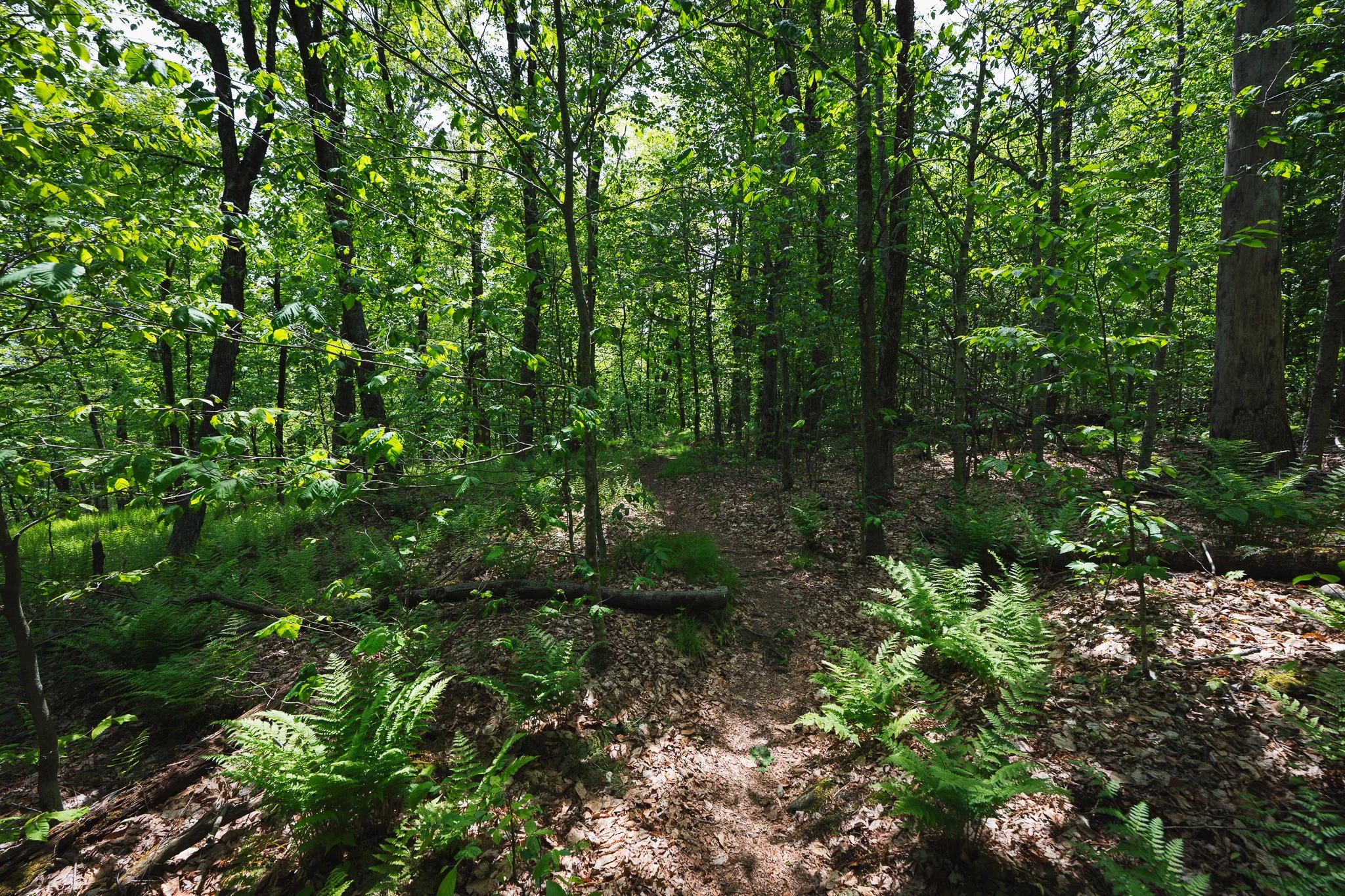
East Mountain
East Mountain is the larger, forested ridge that looms behind the popular Pine Cobble outcropping. While many hikers stop at the "Cobble" for its famous views, continuing to the true summit of East Mountain offers a quieter, more rugged experience within the Clarksburg State Forest. The peak is part of the Hoosac Range and serves as a critical junction where the Pine Cobble Trail meets the legendary Appalachian Trail (AT).
Trail Details
Trailhead Location: The most common approach is via the Pine Cobble Trailhead
on Pine Cobble Road in Williamstown, MA.
Distance: Approximately 4.2-4.3 miles (out-and-back) to reach the East Mountain summit area.
Elevation Gain: Roughly 1,414 feet.
Approximate Time: 2.5 to 3 hours.
Difficulty: Considered hard due to the steady, rocky ascent and the final steep push past the Cobble.
Trail Highlights
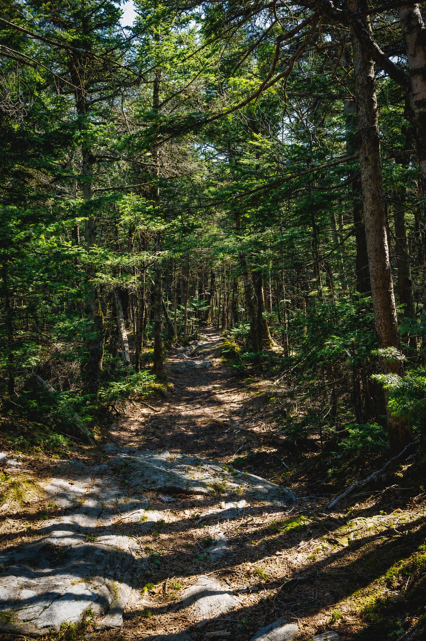
Summit & Views: Unlike the open quartzite outcropping of Pine Cobble, the East Mountain summit is more wooded but features rare pitch pine trees and unique "scrub pine" patches. About 0.5 miles past the Pine Cobble overlook, you’ll find rocky ledges offering westerly views of the Taconic Range and the deep blue Hoosic Valley.
The Junction: The summit area is where the blue-blazed Pine Cobble Trail ends and merges with the white-blazed Appalachian Trail.
Alternate Routes:
Class of ’98 Loop: For a change of scenery on the way down, take the Class of ’98 Trail (accessible from the AT just north of the junction) to create a roughly 5.3-mile loop that passes through scenic ravines.
Long Trail Connection: Hikers can continue north on the AT for about 1.5 miles beyond East Mountain to reach the southern terminus of the Long Trail at the Vermont border.
Unique Geology: The trail is noted for its "cobbles"—rounded quartzite rock outcroppings—and high-elevation blueberry and huckleberry bushes that fruit in July.
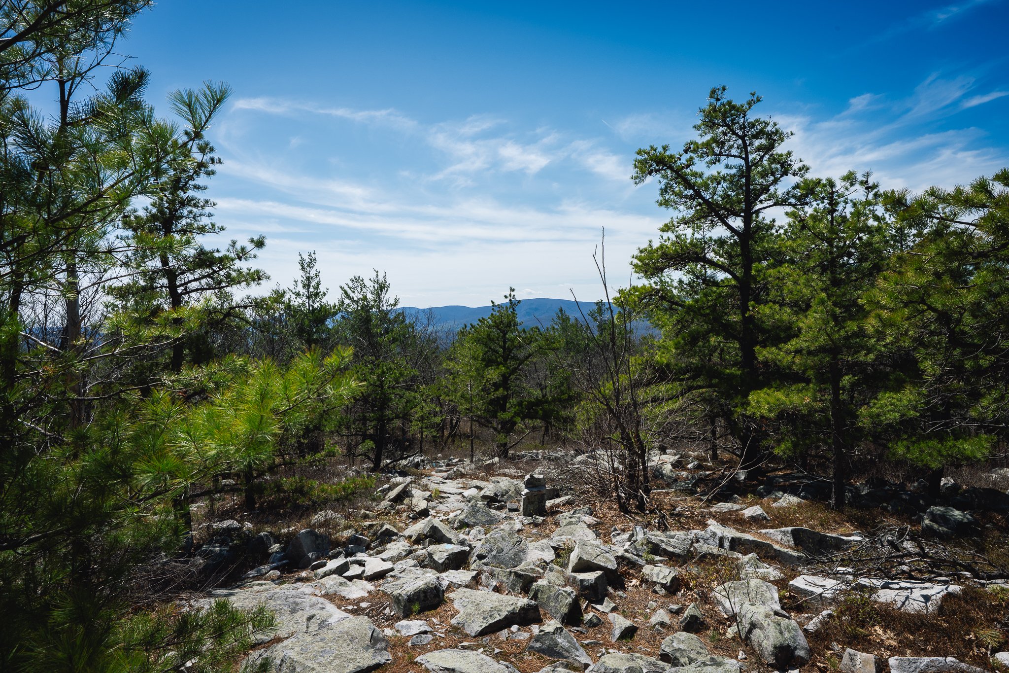
Pine Cobble
Pine Cobble is a beloved hiking destination for locals in Williamstown, renowned for its distinctive quartzite "cobbles" and panoramic views of the northern Berkshires. As a centerpiece of the Williamstown Rural Lands preserve, it offers a moderately challenging climb through diverse forest ecosystems, eventually opening up to one of the most rewarding vistas in the region.
Trail Details
Trailhead Location: The Pine Cobble Trailhead is located on Pine Cobble Road in Williamstown, MA.
Distance: 3.2 miles (out-and-back).
Elevation Gain: Approximately 1,110 feet.
Approximate Time: 1.5 to 2.5 hours.
Difficulty: Considered hard; the trail features a steady, rocky incline that requires sure footing but is manageable for most active hikers.
Trail Highlights
Summit Views: The summit is a large, open field of white quartzite rocks. It offers a spectacular "double-sided" view: to the west, you can see the Taconic Range and the town of Williamstown; to the east, you overlook North Adams, the Hoosac Range, and the Greylock Range.
Unique Ecology: The trail passes through a rare pitch pine-scrub oak community near the top. In the spring and summer, the path is lined with wildflowers and mountain laurel, while the summit area is known for wild blueberry bushes.
Alternate Routes:
Class of ’98 Trail: This trail connects to the main Pine Cobble path, allowing hikers to form a loop. It is slightly steeper and more rugged, passing through a scenic hemlock grove.
Appalachian Trail Access: Continuing 0.5 miles past the Pine Cobble summit leads you directly to the Appalachian Trail, providing an easy link for those looking to extend their hike toward East Mountain or the Vermont border.
Local History: The "cobbles" themselves are part of a 500-million-year-old geological formation, and the trail is meticulously maintained by local conservation groups and Williams College students.
Spruce Hill
Spruce Hill is the premier lookout on the Hoosac Range, a dramatic ridge that forms the northeastern wall of the Berkshires. Known for its expansive 180-degree views and unique ridge-top forest, the trail to Spruce Hill offers a classic Appalachian experience without the extreme elevation gain of neighboring Mount Greylock. It is a highlight of the Hoosac Range Reserve, managed by the Berkshire Natural Resources Council (BNRC).
Trail Details
Trailhead Location: The main trailhead is located on the south side of Route 2 (Mohawk Trail) in North Adams, just past the "Hairpin Turn" and the Wigwam Western Summit.
Distance: Approximately 6.0 miles (out-and-back).
Elevation Gain: Roughly 600-900 feet (the trail is relatively level along the ridge after an initial climb).
Approximate Time: 3 to 4 hours.
Difficulty: Moderate; while the length is significant, the terrain is mostly rolling along the ridgeline with only a few steep, rocky sections near the summit.
Trail Highlights
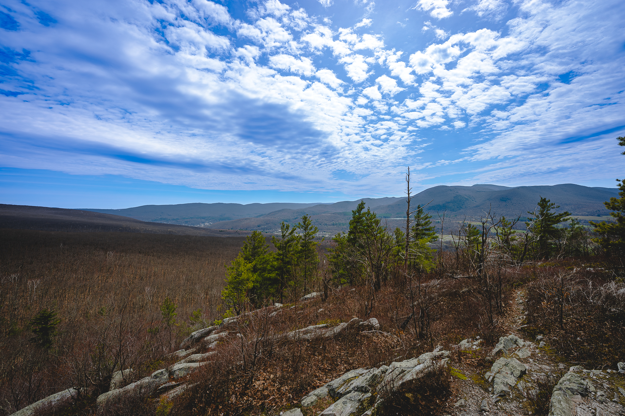
Summit Views: The summit of Spruce Hill features a wide, rocky outcropping with a 180-degree panoramic view to the west. On clear days, you have an unobstructed view of Mount Greylock, the town of Adams, and the Green Mountains of Vermont to the north.
Sunset Rock: Located just 0.8 miles from the trailhead, Sunset Rock is a popular shorter destination that offers similar western-facing views, perfect for a quick evening hike.
Alternate Routes:
Busby Trail: For a different approach, you can reach Spruce Hill from the south via the Busby Trail, starting in Savoy Mountain State Forest. This route is roughly 3 miles round-trip and passes through deep hardwood forests.
Mahican-Mohawk Trail: The path to Spruce Hill is actually a segment of the historic 100-mile Mahican-Mohawk Trail, which follows ancient Native American travel routes between the Hudson and Connecticut River valleys.
Geological & Historical Interest: As you hike, you are walking directly above the Hoosac Tunnel (look for old power lines that lead to the remnants of the historic Spruce Hill Alignment Tower), one of the longest railroad tunnels in North America. The ridge is also known for its "Yoda Tree"—a tree with a distinctive burl—and wind-stunted vegetation typical of high-exposure environments.
Ragged Mountain
Ragged Mountain is a prominent, ridge-like spur flanking the eastern side of the Mount Greylock State Reservation. Sitting directly east of Mount Fitch and Mount Williams, Ragged Mountain forms the eastern wall of the Bellows Pipe valley. Though it is one of the lower-named peaks within the reservation (2,490 feet), it offers a highly rugged, isolated backcountry experience that rewards hikers with spectacular, atypical angles of the towering Greylock summit across the ravine.
Trail Details
Trailhead Location: The most practical approach starts at the Bellows Pipe South Trailhead on Gould Road in Adams, MA.
Distance: Approximately 4.25-5.0 miles (out-and-back).
Elevation Gain: Roughly 1,250-1,375 feet.
Approximate Time: 2.5 to 3.5 hours.
Difficulty: Moderate to Hard; the approach along the Bellows Pipe Trail is a steady climb, while the final push up the specialized Ragged Mountain connector trail becomes narrow, steep, and rocky.
Trail Highlights
The Summit Ledge: While portions of Ragged Mountain are wooded, the true highlight is a stunning open rock outcropping, known as Raven Rocks, near the peak. This vantage point provides an incredible, front-row look directly west across the valley toward the massive slopes of Mount Fitch, Mount Williams, and the Mount Greylock War Memorial Tower.
The Bellows Pipe Wilderness: The first leg of the hike follows the historic, wide double-track Bellows Pipe Trail, traveling through a peaceful northern hardwood forest of red oaks and maples. The trail crosses cascading mountain brooks that provide a high-quality ambiance.
Alternate Routes:
The Northern Approach: Hikers can start at the Bellows Pipe North Trailhead off Notch Road in North Adams. This route spans about 5.2 miles round-trip and runs along the northern edge of the reservation.
Raven Rocks Loop: Ambitious hikers can follow the East Ridge Path just past the summit to pass by Raven Rocks and the Fox Den, showcasing dramatic cliff faces along the mountain's eastern rim.
Geological Anomalies: The ridge features rugged rock formations, dramatic drop-offs, and the hidden Ragged Mountain Cave system, a large subterranean fracture cave prized by regional spelunkers.
Mount Prospect
Mount Prospect is a rugged, prominent peak located on the northwestern shoulder of theMount Greylock State Reservation. Often overshadowed by its more famous neighbor, Mount Prospect offers a steep, aggressive climb and a more solitary experience for hikers looking to explore the wilder, western side of the Greylock massif. The peak is known for its dramatic ridgeline and its historical connection to the Appalachian Trail, which traverses its summit.
Trail Details
Trailhead Location: The most direct access is from the Hopper Road Trailhead in Williamstown, MA.
Distance: Approximately 5.7-6.0 miles (out-and-back) via the Money Brook and Mount Prospect Trails.
Elevation Gain: Roughly 1,590-1,722 feet.
Approximate Time: 3 to 4 hours.
Difficulty: Hard; the ascent from the Money Brook valley is notoriously steep, with some sections reaching a 25 percent grade.
Trail Highlights
Summit Views: The actual summit of Mount Prospect is wooded and marked by a large rock cairn. However, the true highlight is the Prospect Mountain overlook located just south along the ridge, which provides a stunning western view of the Hopper (a massive natural amphitheater), Williamstown, and the Taconic Range.
The "Nose" Ridge: The trail "tightropes" along a narrow, rocky ridgeline, offering frequent peek-a-boo views through the trees toward Stony Ledge and the Green Mountains of Vermont.
Alternate Routes:
The Greylock Loop: For an all-day epic, many hikers combine Mount Prospect with Mount Williams, Mount Fitch, and Mount Greylock to create a strenuous 12.8-mile loop that bags several of the state’s highest peaks.
Notch Road Approach: During the summer, when the auto road is open, you can start from the Money Brook Falls parking lot on Notch Road for a shorter but still rugged loop over the summit.
Pattison Road Approach: This route begins on the southern side of the road and immediately challenges hikers with a steep, sustained ascent that skips the lower valley floor associated with the Hopper Road approach.
Money Brook Falls: Most routes to Mount Prospect pass near Money Brook Falls, a beautiful 70-foot tiered waterfall that is especially powerful in the spring.
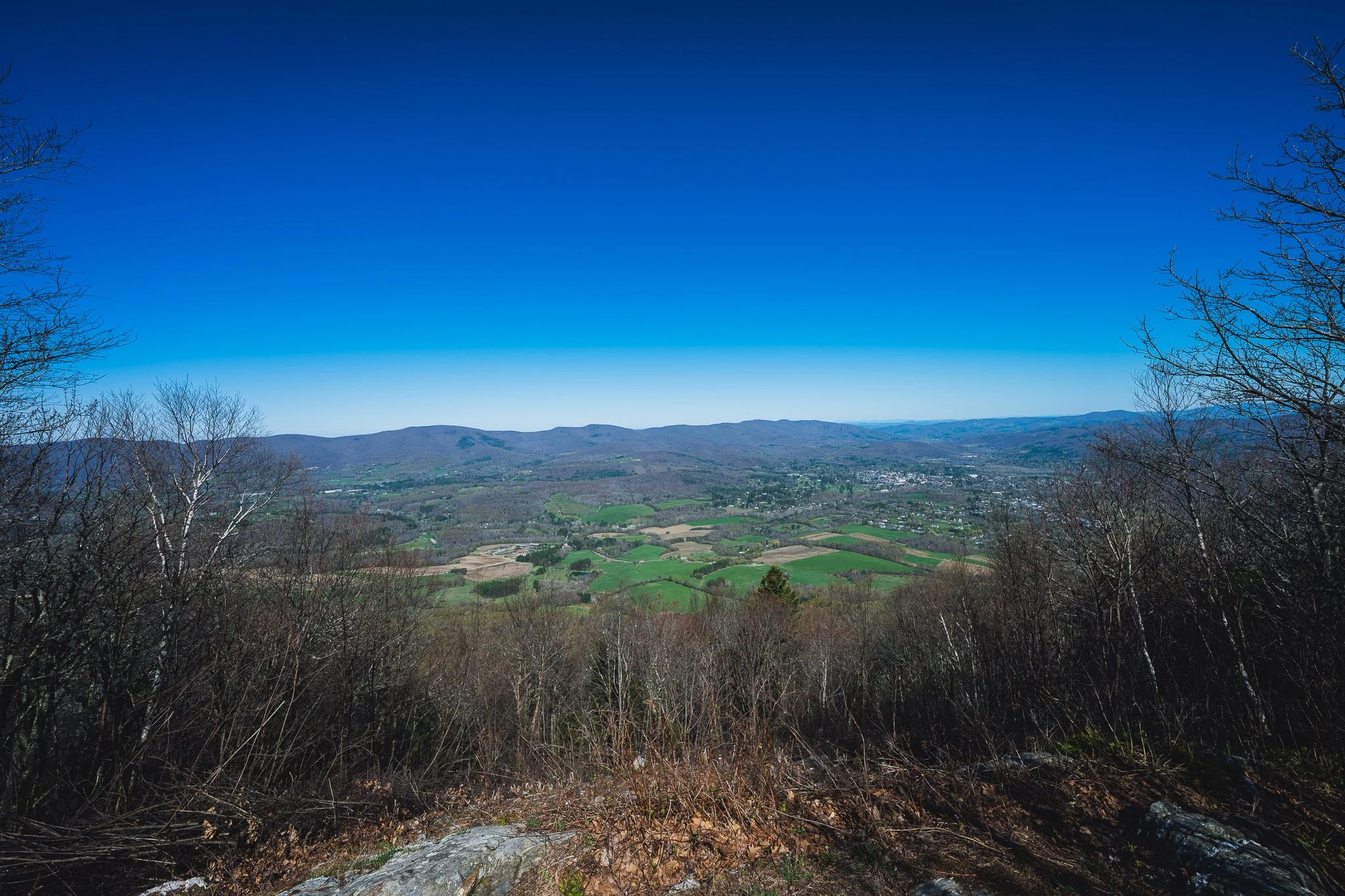
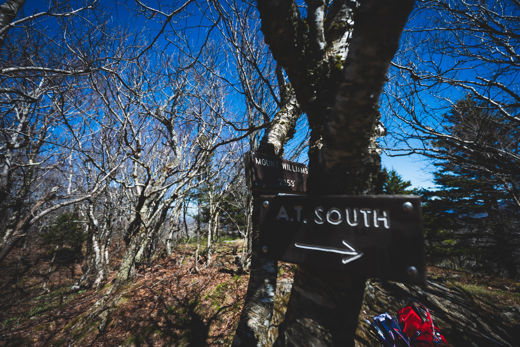
Mount Williams
Mount Williams is the northernmost high peak of the Mount Greylock range, serving as the dramatic "entrance" to the massif for those hiking south. Named after Colonel Ephraim Williams, the founder of Williams College, the peak is heavily forested but offers several scenic vistas that showcase the rugged transition from the Hoosic Valley to the high-elevation spruce-fir forests typical of the Mount Greylock State Reservation.
Trail Details
Trailhead Location: The most popular access point is the Appalachian Trail crossing on Pattison Road in North Adams.
Distance: Approximately 5.0 miles (out-and-back).
Elevation Gain: Roughly 1,980 feet.
Approximate Time: 3 to 4.5 hours.
Difficulty: Hard; this is a sustained, steep climb that gains elevation quickly as it ascends from the valley floor to nearly 3,000 feet.
Trail Highlights
Summit Vistas: While the true summit (2,951 feet) is partially wooded, there are clearings near the top that provide stunning panoramic views to the north and east. You can see the city of North Adams tucked into the valley, the Hoosac Range, and the Green Mountains of Vermont stretching into the distance.
Boreal Forest Transition: As you climb, you’ll notice the hardwood forest shift into a dense "boreal" forest of red spruce and balsam fir, which gives the air a crisp, evergreen scent even in the heat of summer.
Alternate Routes:
The Notch Road Shortcut: During the summer and fall, you can park at the Money Brook Falls lot on Notch Road. From there, it is a much shorter 1.4-mile round trip to the summit with significantly less elevation gain.
The Three-Peak Traverse: Many hikers continue south on the AT to cross Mount Fitch before reaching the summit of Mount Greylock, making for an iconic 8-9 mile point-to-point or out-and-back.
Wilbur’s Clearing: Just south of the summit lies Wilbur’s Clearing, a historic site with a lean-to shelter that is a favorite resting spot for thru-hikers and a great place to spot local bird species like the Black-capped Chickadee.
Mount Fitch
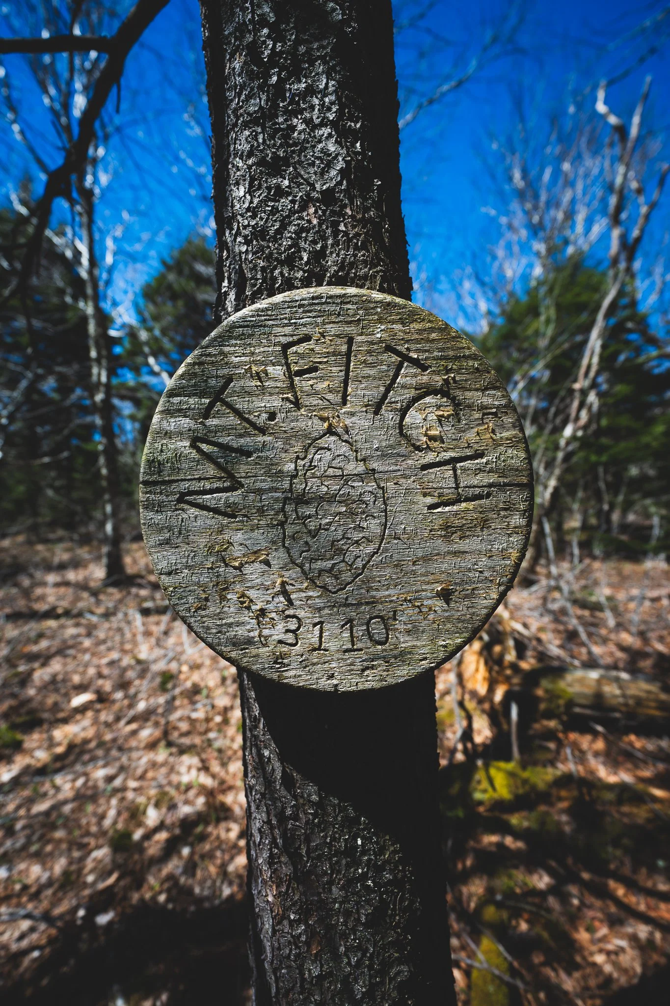
Mount Fitch is a quiet, densely forested peak situated between Mount Williams and the Mount Greylock summit. While it is the second-highest point in Massachusetts (3,110 feet), it is often bypassed by those racing toward the War Memorial Tower. However, for those who value solitude and the unique atmosphere of high-altitude spruce-fir forests, Mount Fitch offers a serene, "deep woods" experience that feels more like the remote ridges of Vermont than the popular trails nearby.
Trail Details
Trailhead Location: The most common starting point is the Appalachian Trail crossing on Pattison Road in North Adams.
Distance: Approximately 7.2-7.5 miles (out-and-back) from Pattison Road.
Elevation Gain: Roughly 2,150 feet.
Approximate Time: 4 to 5.5 hours.
Difficulty: Hard; this route involves the long, steep climb past Mount Williams and steady ridgeline hiking with rocky underfoot conditions.
Trail Highlights
Summit & Vistas: The true summit of Mount Fitch is wooded and lacks a direct view, but just south of the peak on the Appalachian Trail, there is a spectacular western overlook. This ledge provides a clear view of Stony Ledge, the deep Hopper valley, and the distant Taconic Range.
Boreal Sanctuary: Mount Fitch is home to some of the finest examples of old-growth red spruce in the state. The trail here is often cooler and more humid than the lower slopes, creating a mossy, primeval environment.
Alternate Routes:
Notch Road Access: For a much easier visit, park at the Fitch Overlook pull-off on Notch Road. A very short spur trail connects the road directly to the Appalachian Trail near the summit ridge.
The "Three Peak" Loop: Many hikers approach Mount Fitch as part of a larger loop from Hopper Road, ascending via the Money Brook Trail to Wilbur's Clearing, then traversing Mount Williams, Mount Fitch, and Mount Greylock before descending via the Hopper Trail.
Robinson's Point: Located on a side trail between Mount Fitch and Mount Greylock, Robinson's Point offers another unique perspective of the Money Brook ravine and the southern spine of Mount Prospect.
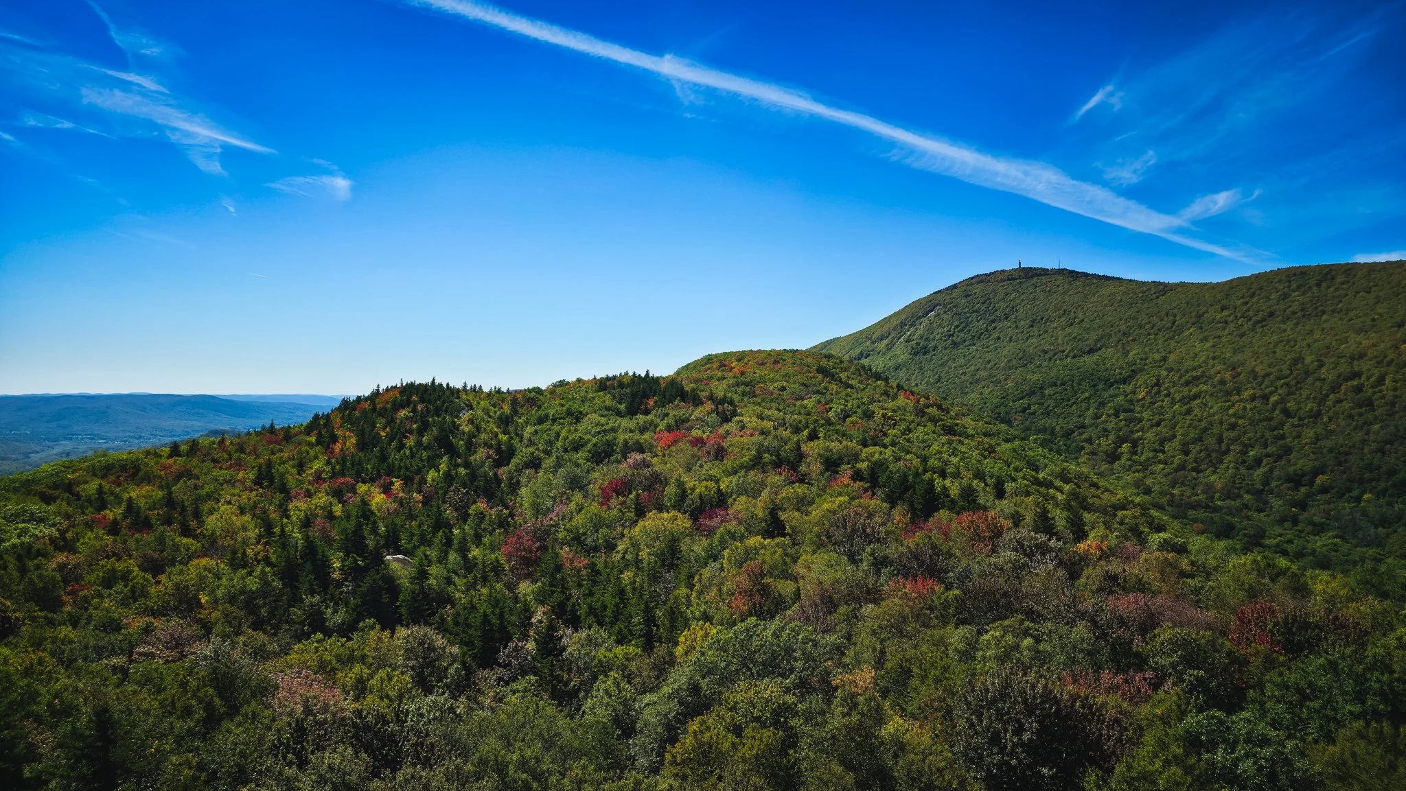
Mount Greylock
Mount Greylock is the highest point in Massachusetts, standing at 3,491 feet. As the crown jewel of the Mount Greylock State Reservation, it served as the inspiration for literary icons like Herman Melville and Nathaniel Hawthorne. The summit is famous for the 93-foot Veterans War Memorial Tower and the historic Bascom Lodge, offering a rare combination of rugged alpine beauty and historic New England architecture.
Trail Details
Trailhead Location: Multiple access points exist, but the most iconic is the Hopper Road Trailhead in Williamstown or the CCC Parking Lot in Lanesborough.
Distance: Varies; approximately 6.0-12.0 miles (round-trip) depending on the route.
Elevation Gain: Roughly 2,000 to 2,400 feet from the valley floor.
Approximate Time: 4 to 7 hours.
Difficulty: Hard; whether ascending via the steep Hopper/Cheshire Harbor trails or the long Appalachian Trail, hikers should prepare for significant elevation change and rocky terrain.
Trail Highlights
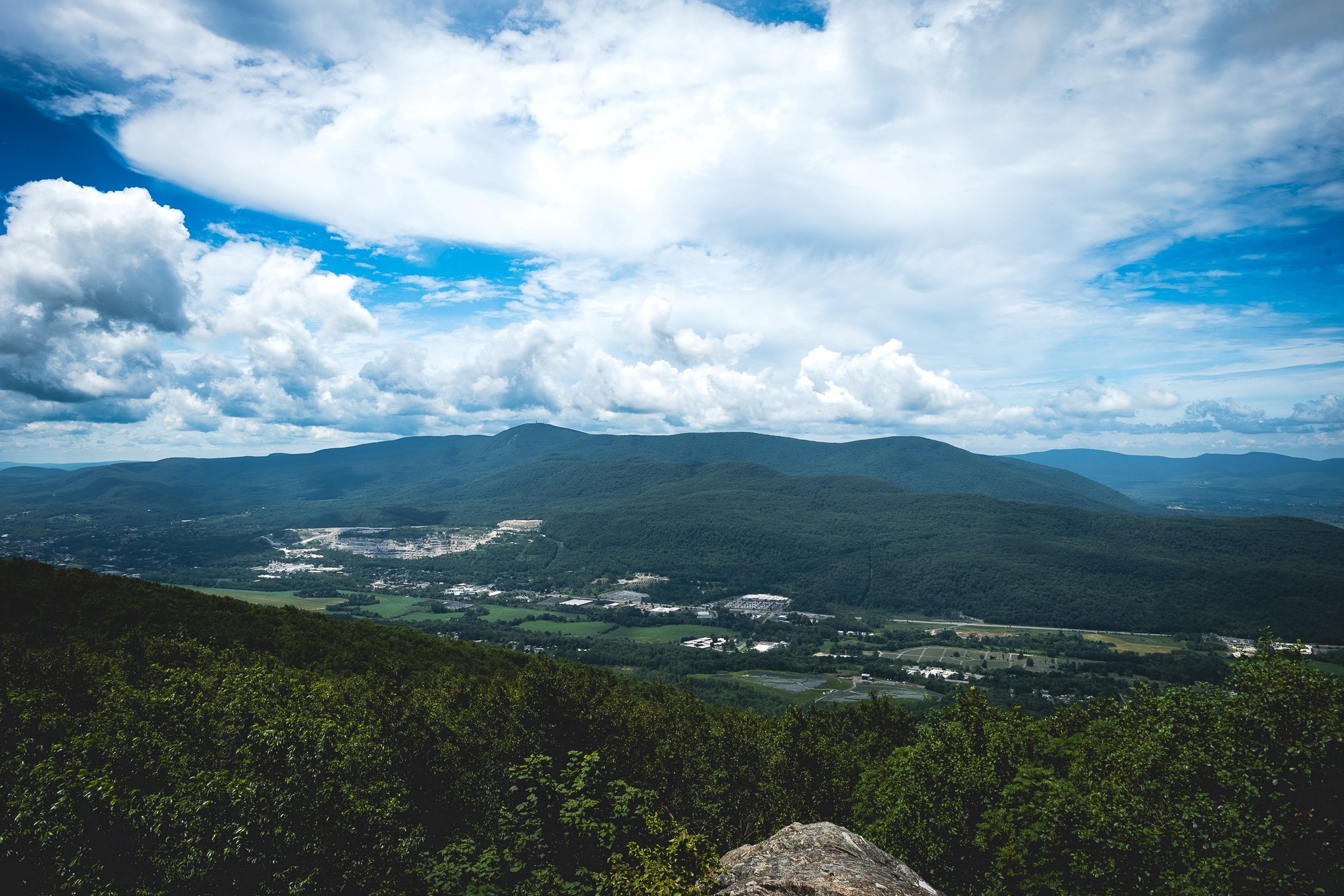
Summit Views: On a clear day, the summit offers a stunning 90-mile panoramic view spanning five states: Massachusetts, New York, Vermont, New Hampshire, and Connecticut. The view into the "Hopper" amphitheater is a highlight of the western ledge.
Bascom Lodge & War Memorial: The summit features Bascom Lodge, a hand-hewn stone and log building from the 1930s that offers food and lodging. The War Memorial Tower serves as a lighthouse for the Berkshires and can be climbed for even higher vantage points.
Alternate Routes:
Bellows Pipe Trail: A favorite for winter sports and summer hikes, this trail passes through the notch between Greylock and Ragged Mountain.
Cheshire Harbor Trail: Widely considered the "easiest" route to the top, it follows a steady, wide old carriage road with more gradual grades.
Thunderbolt Ski Trail: A legendary, extremely steep backcountry ski trail that provides a grueling direct ascent for experienced hikers.
Stony Ledge
Stony Ledge is a prominent limestone and quartzite outcropping located on the western rim of the Mount Greylock massif. While it sits at a lower elevation than the main peaks (approximately 2,560 feet), it is widely considered to have the most spectacular view in the entire state. It looks directly into the heart of the "Hopper," a massive, 1,000-foot-deep glacial cirque, offering a dizzying perspective of Mount Greylock’s summit that you can't get from the top itself.
Trail Details
Trailhead Location: The most popular approach is from the Hopper Road Trailhead in Williamstown, MA.
Distance: 4.2 miles (out-and-back) via the Stony Ledge Trail.
Elevation Gain: Approximately 1,400 feet.
Approximate Time: 2.5 to 3.5 hours.
Difficulty: Moderate to Hard; the trail is a steady, relentless climb up an old wood road, which is wide but quite steep in sections.
Trail Highlights
The Overlook: The "Ledge" is a massive rock platform that provides a direct, head-on view of the summit of Mount Greylock, the War Memorial Tower, and the sheer walls of the Hopper. To the west, you can see the rolling hills of the Taconic Range and the New York border.
Camping: Just behind the overlook is the Stony Ledge group camping area, making it a favorite spot for backpackers who want to wake up to a sunrise over the Greylock summit.
Alternate Routes:
Haley Farm Trail: For a more scenic but longer loop (about 6.5 miles), ascend via the Haley Farm Trail, which passes through beautiful open meadows with views of the valley before entering the woods.
Sperry Road: During the summer, those who don't want to hike from the bottom can drive up the Greylock auto road and take an easy, nearly flat 1.5-mile walk from the Campground parking lot.
Seasonal Beauty: The ledge is a premier spot for foliage viewing in October, as the maples in the Hopper below turn a vibrant sea of red and orange.
Saddle Ball Mountain
Saddle Ball Mountain is a sprawling, high-elevation ridge located just south of Mount Greylock’s main summit. While it is the third-highest peak in Massachusetts (3,238 feet), it feels worlds apart from the bustling activity of the War Memorial. The mountain is characterized by a long, undulating plateau covered in a dense boreal forest, offering hikers a remote, wilderness atmosphere and some of the most pristine sections of the Appalachian Trail in the state.
Trail Details
Trailhead Location: The most direct access is from the Jones Nose Trailhead on Rockwell Road in Lanesborough, MA.
Distance: Approximately 4.5-5.0 miles (out-and-back) via the Jones Nose and Appalachian Trails.
Elevation Gain: Roughly 1,000-1,200 feet.
Approximate Time: 2.5 to 3.5 hours.
Difficulty: Moderate; while it reaches high elevations, starting from Rockwell Road eliminates much of the valley-to-peak climb, though the terrain remains rocky and often muddy.
Trail Highlights
The Boreal Plateau: The summit area is a high-altitude sanctuary of stunted red spruce and balsam fir. The trail winds through deep moss and evergreen thickets that stay cool and misty even in mid-summer, providing a habitat for high-elevation birds like the Bicknell's Thrush.
Hidden Vistas: Like Mount Fitch, the true summit is wooded, but several unmarked spur paths and clearings along the ridge offer narrow "windows" looking south toward Cheshire Reservoir and the Berkshire Valley.
Alternate Routes:
Cheshire Harbor Approach: For a much longer and more strenuous "valley-to-peak" experience, you can ascend via the Cheshire Harbor Trail and join the AT heading south from the base of the Greylock summit.
The Southern Traverse: Many hikers include Saddle Ball as part of a point-to-point trek starting from Route 8 in Cheshire, a grueling climb that ascends the mountain's steep southern flank.
Old Growth Forest: The western slopes of Saddle Ball contain significant stands of old-growth forest, where ancient yellow birches and hemlocks have remained undisturbed for centuries.
The Cobbles
The Cobbles (also known as the Cheshire Cobbles) is a dramatic quartzite outcropping located on the southern end of the Mount Greylock range. Rising sharply above the town of Cheshire, this destination is famous for its bright white rock formations and its "front-row" view of the massive Greylock summit and the Hoosic Valley. It serves as a popular destination for both local day hikers and Appalachian Trail thru-hikers looking for a scenic rest point before the long climb north.
Trail Details
Trailhead Location: The most common access is from Shedd Road in Cheshire, MA, where the Appalachian Trail crosses the street.
Distance: Approximately 3.4 miles (out-and-back).
Elevation Gain: Roughly 900-1,000 feet.
Approximate Time: 2 to 2.5 hours.
Difficulty: Moderate; the trail involves a steady, fairly steep climb through the woods with some rocky and uneven footing as you approach the ledges.
Trail Highlights
Summit Vistas: The highlight is a series of open, glacier-scoured quartzite ledges that provide a stunning panoramic view to the north and west. From here, you have an unobstructed sightline of the Mount Greylock War Memorial Tower and the southern ridges of the Greylock massif.
Unique Geology: The "Cobbles" are composed of Cheshire Quartzite, a very hard, white rock that resists erosion. These formations create a unique micro-environment for hardy shrubs and lichens that thrive on the exposed, sun-drenched stone.
Alternate Routes:
Cheshire Town Center: You can start your hike directly from the Ashuwillticook Rail Trail parking lot in downtown Cheshire. This adds a bit of road walking but allows you to experience the AT as it transitions from a "town walk" into the deep woods.
Gore Mountain Link: Ambitious hikers can continue north past the Cobbles on the AT toward Saddle Ball Mountain for a much longer, more remote day of hiking.
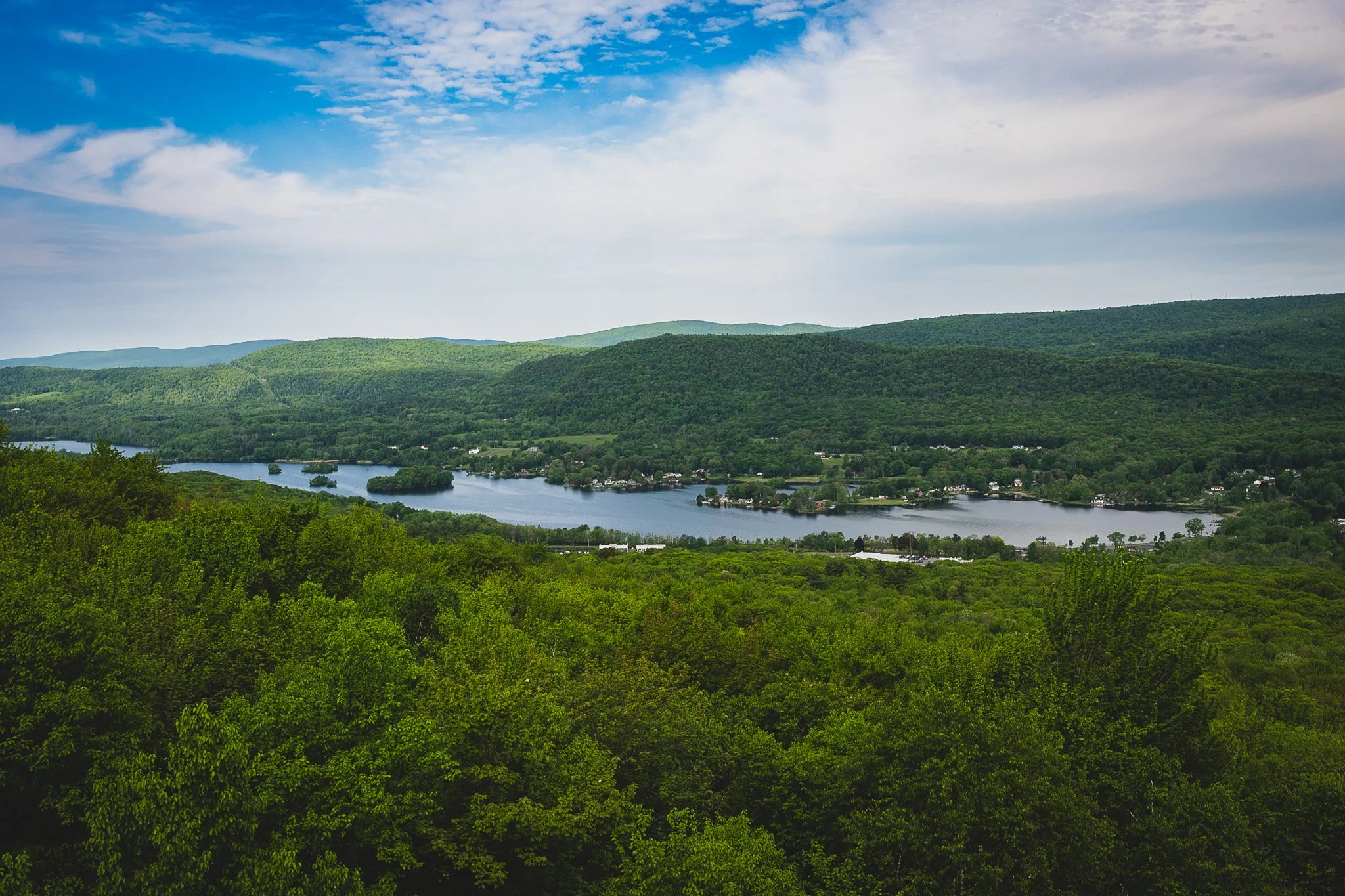
The "Cheshire View": Because the Cobbles sit directly above the town, you get a unique bird's-eye view of the Cheshire Reservoir and the winding path of the Hoosic River below.
North Mountain
North Mountain is a rugged, often-overlooked peak situated on the southern spine of the Mount Greylock State Reservation. Located just south of The Cobbles, it serves as a high-altitude "shoulder" that hikers must traverse when heading toward the main Greylock massif from the town of Cheshire. It offers a dense, wilderness feel with steep, rocky terrain that marks the transition from the valley floor to the high-elevation boreal forests.
Trail Details
Trailhead Location: The most common approach is from Shedd Road in Cheshire, MA, following the Appalachian Trail south through The Cobbles.
Distance: Approximately 5.5-6.0 miles (out-and-back) from Shedd Road.
Elevation Gain: Roughly 1,400-1,600 feet.
Approximate Time: 3.5 to 5 hours.
Difficulty: Hard; while the climb to The Cobbles is moderate, the push further north toward the summit of North Mountain involves more technical, rocky footing and sustained inclines.
Trail Highlights
The Ridge Transition: As you move past the white quartzite of The Cobbles and onto the slopes of North Mountain, the forest shifts dramatically from mixed hardwoods to a darker, more primitive canopy. The summit is largely wooded, but the journey along the narrow ridgeline offers occasional framed views of the Cheshire Reservoir to the south.
Gore Mountain Connection: North Mountain is often hiked as part of the traverse toward Gore Mountain and Saddle Ball. This stretch of the Appalachian Trail is known for its deep mosses, high-altitude ferns, and significant solitude compared to the summit of Greylock.
Alternate Routes:
Gould Road: For those looking to avoid the climb from Cheshire, you can access the northern side of North Mountain via the Gould Trail or Cheshire Harbor Trail systems, looping back south on the AT.
The "Town to Summit" Traverse: Ambitious hikers use North Mountain as the mid-point of a grueling 12+ mile trek from the center of Cheshire all the way to the Mount Greylock summit.
Remote Wilderness: Because there are no auto roads or major scenic overlooks directly on the summit, North Mountain is a prime location for spotting wildlife, including moose, black bears, and various high-altitude migratory birds that avoid the more populated peaks.
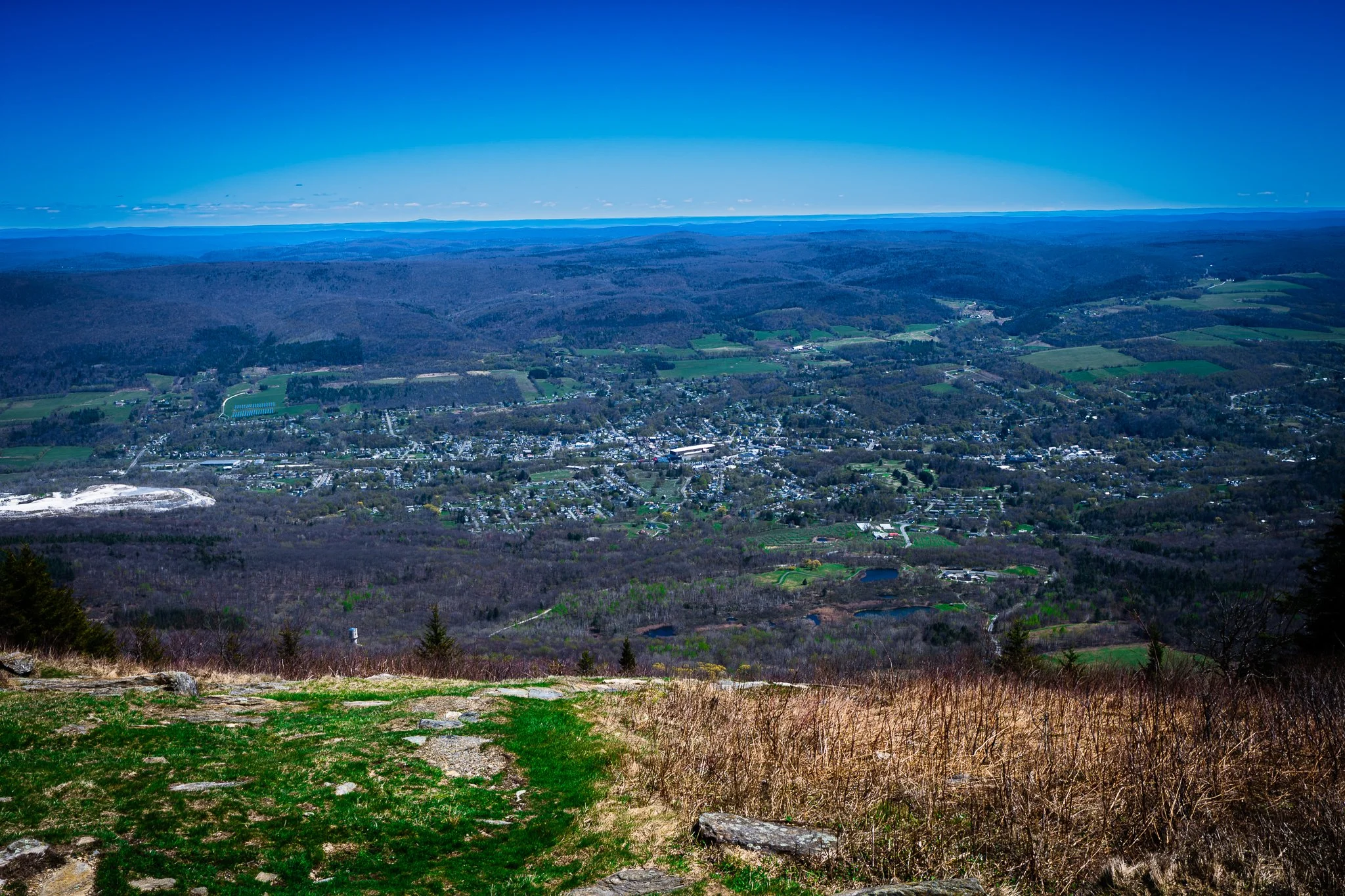
Day Mountain
Day Mountain is a prominent, wooded peak located just south of the town of Dalton. It serves as a key segment of the Appalachian Trail (AT) and acts as a gateway to the more remote sections of the southern Berkshires. Known for its gentle approach and peaceful surroundings, Day Mountain is a favorite for those who enjoy "forest bathing" and a moderate climb without the intense crowds found at larger Berkshire summits.
Trail Details
Trailhead Location: The most direct northern approach starts at the Appalachian Trail crossing on Grange Hall Road in Dalton, MA.
Distance: Approximately 2.6-3.0 miles (out-and-back).
Elevation Gain: Roughly 600-700 feet.
Approximate Time: 1.5 to 2.5 hours.
Difficulty: Moderate; the climb is steady but much more gradual than the steep scrambles found on nearby North Mountain, making it accessible for most active hikers.
Trail Highlights
Summit Solitude: The summit of Day Mountain is fully wooded, offering a serene "green cathedral" atmosphere. While it lacks a grand panoramic vista, the summit area is noted for its impressive boulder formations and a high-elevation swamp nearby that attracts diverse birdlife.
The Fern Glades: This section of the trail is famous for its massive carpets of ferns, including Cinnamon and Interrupted ferns, which create a vibrant, prehistoric-looking forest floor during the summer months.
Alternate Routes:
Town-to-Mountain: Many locals start directly from the Main Street (Route 9) trailhead in Dalton, which adds about 2 miles of flat walking through town and forest before reaching the base of the mountain.
Warner Hill Extension: Continuing south on the AT past Day Mountain for another 2 miles leads to Warner Hill, which offers the open, grassy-summit views that Day Mountain lacks.
Wildlife Observation: Because this trail is less frequented than others in the region, it is an excellent place to spot wild turkey, white-tailed deer, and occasionally moose, which frequent the damp, low-lying areas between the ridges.
Tully Mountain
Tully Mountain is a high, heavily forested peak that serves as the literal high point of the town of Hinsdale. Reaching an elevation of 2,084 feet, it offers a remote and rugged wilderness atmosphere along a peaceful stretch of the Appalachian Trail. This peak provides hikers with an immersive "deep woods" experience away from the busier sections of the Berkshire AT corridors.
Trail Details
Trailhead Location: The most practical approach starts at the Appalachian Trail parking area on Blotz Road in Washington/Hinsdale, MA.
Distance: Approximately 3.0-3.5 miles (out-and-back) from the Blotz Road access point.
Elevation Gain: Minimal; roughly 300-400 feet, as the trailhead is already high on the ridge.
Approximate Time: 1.5 to 2.5 hours.
Difficulty: Moderate; while the elevation gain is gentle, the trail features uneven footing, roots, and typical rocky Appalachian singletrack.
Trail Highlights
Summit & Highpoint: The summit of Tully Mountain is densely wooded, with no direct views from the top or along the trail. The true high point sits roughly 200 feet southwest of a sharp bend in the Appalachian Trail and is traditionally found by bushwhacking to a historic fallen telephone pole.
Warner Hill Panorama: Because Tully Mountain lacks views, hikers almost always combine it with a stop at nearby Warner Hill. Located just across a gentle saddle, Warner Hill features open fern meadows and a stunning panoramic view with Mount Greylock looming in the distance.
Alternate Routes:
The Washington to Dalton Traverse: Ambitious backpackers cross over Tully Mountain as part of a grueling 17.7-mile point-to-point traverse between Washington Mountain Road and Dalton.
Grange Hall Road Approach: Hikers can also approach the mountain from the north, starting at Grange Hall Road, which takes you south past Day Mountain before hitting Tully.
Glacial Topography: The area features striking geographic depressions and smoothed-off ridges. The trail passes wild berry bushes—including blackberries and blueberries—that fruit in the late summer.
Warner Hill
Warner Hill is a scenic, open summit located along the Appalachian Trail (AT) on the border of Hinsdale and Washington. Known for providing one of the highest effort-to-reward ratios in the central Berkshires, this peak features a grassy, open clearing that breaks up the region’s dense forest canopy. It is a highly popular destination for a quick family jaunt, birdwatching, and berry picking, thanks to an expansive viewshed protected by the Trust for Public Land and the National Park Service.
Trail Details
Trailhead Location: The most direct approach begins at the Appalachian Trail crossing on Blotz Road (sometimes referred to as Kirchner Road) on the Washington/Hinsdale town line.
Distance: Approximately 1.4-1.5 miles (out-and-back).
Elevation Gain: Roughly 200 feet.
Approximate Time: 45 minutes to 1 hour.
Difficulty: Easy; the grade is generally gentle and highly family-friendly, though it contains standard woodland roots and a brief moderate climb through an old spruce plantation.
Trail Highlights
Summit Views: Unlike many heavily forested peaks in the area, the 2,057-foot summit of Warner Hill is wide open. It offers a spectacular panoramic view to the north and northwest, where you can see Mount Greylock on the horizon, the Green Mountains of Vermont, the Taconic Range, and the city of Pittsfield tucked below.
Blueberry Meadows: The open summit is crowded with wild, high-bush blueberry and blackberry bushes. Visiting in mid-to-late July provides hikers with a prime wild berry harvest right alongside the trail.
Alternate Routes:
The Northern Approach: Hikers can start further north at Grange Hall Road in Dalton, hiking south for about 3.5 miles over Tully Mountain to reach Warner Hill.
Washington Mountain Road Point-to-Point: Leaving a second car at the Washington Mountain Road trailhead to the south allows for a gentle, 2.8-mile one-way traverse that passes the October Mountain Shelter.
Ecological Renewal: The lower stretch of the trail passes through a historic, 100-year-old Norway Spruce plantation. Hikers can observe active conservation efforts where volunteer trail crews are removing dying, non-native trees to allow the native Berkshire hardwood forest to regenerate.
Bald Top
Bald Top is a rugged, high-elevation peak along the Appalachian Trail (AT) located in the deep interior of October Mountain State Forest. Situated south of Warner Hill, this 2,051-foot summit offers a remote wilderness experience that showcases the active ecological restoration of the Berkshire highlands. Once entirely cleared for pasture and later blanketed by tree plantations, the mountain is now a premier destination for those seeking solitude and a classic, deep-woods Appalachian trek.
Trail Details
Trailhead Location: The most direct approach begins at the Appalachian Trail crossing on County Road in Washington, MA.
Distance: Approximately 2.0-2.2 miles (out-and-back) to the summit area.
Elevation Gain: Roughly 550-600 feet.
Approximate Time: 1 to 1.5 hours.
Difficulty: Moderate; the trail starts with an immediate, steep climb from County Road through rocky sections before leveling off along the high ridge.
Trail Highlights
The Regenerating Summit: True to its name, Bald Top was historically an open pasture. While it is no longer bald and features a dense canopy, the summit ridge offers beautiful "peek-a-boo" winter views of the surrounding Berkshire Hills and the distant Hoosac Range through the trees.
October Mountain Shelter: Continuing north past the summit for roughly 1.9 miles along the AT leads directly to the October Mountain Shelter and Campsite. This primitive lean-to is a favorite resting spot for long-distance thru-hikers and an excellent day-hike extension.
Alternate Routes:
The Northern Approach: Hikers can start further north at the Washington Mountain Road trailhead and hike south. This 4.1-mile one-way route passes multiple beaver ponds and the October Mountain Shelter before ascending the gentler northern slope of Bald Top.
Becket Mountain Traverse: For a longer, multi-peak day, backpackers can head south from the summit to cross over Walling Mountain and Becket Mountain, ending at Route 20.
Ecological Restoration: The slopes of Bald Top feature a notable environmental success story. A non-native Norway Spruce plantation was removed by conservation crews, allowing the native Berkshire northern hardwood forest—including birch, maple, and beech—to vibrantly regenerate.
Walling Mountain
Walling Mountain is a heavily wooded, high-elevation peak located in the southern tier of October Mountain State Forest on the border of Becket and Washington. Standing at 2,220 feet, this peak offers a rugged and primitive backcountry experience along a serene stretch of the Appalachian Trail (AT). Situated just south of Bald Top, Walling Mountain treats hikers to dense hardwood canopies, quiet ridgelines, and an intimate look at the central Berkshire wilderness.
Trail Details
Trailhead Location: The most practical approach for a day hike begins at the Appalachian Trail crossing on County Road in Washington, MA.
Distance: Approximately 4.6-4.8 miles (out-and-back).
Elevation Gain: Roughly 750-850 feet of cumulative gain.
Approximate Time: 2.5 to 3.5 hours.
Difficulty: Moderate to Hard; the trail requires navigating typical Appalachian singletrack defined by mud, roots, steep rock scrambles, and slippery stepping stones.
Trail Highlights
Summit & Ridgeline: The 2,220-foot summit of Walling Mountain is largely wooded and overgrown, lacking a grand panoramic viewpoint. However, the real draw is the quiet journey along the high-altitude ridgeline, which treats hikers to "peek-a-boo" glimpses of the rolling hills surrounding Goose Pond to the south.
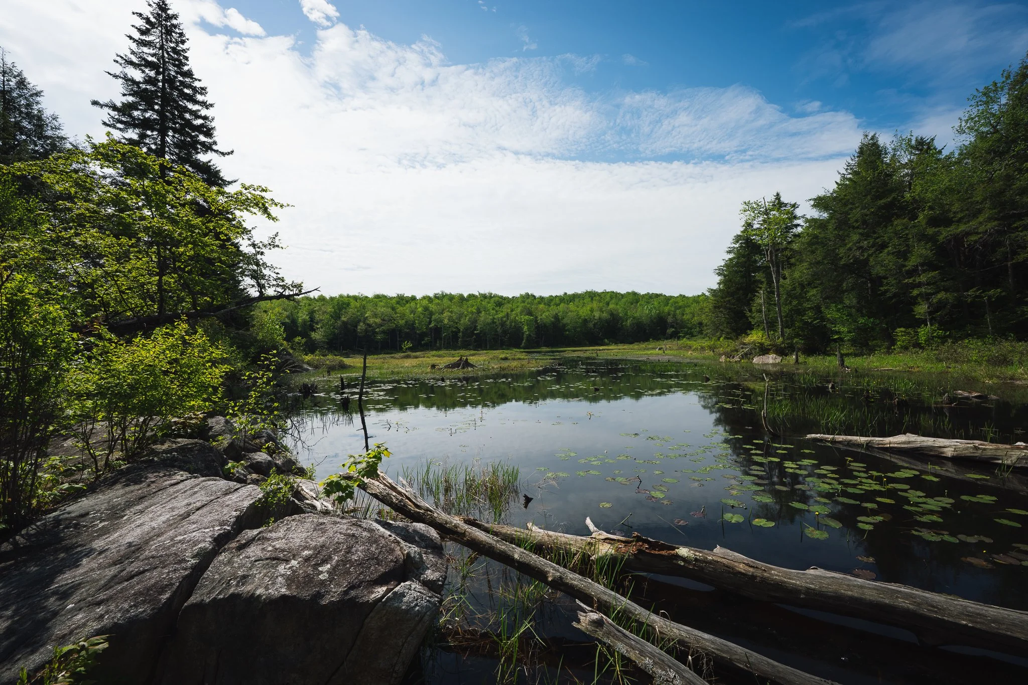
Finerty Pond: Nestled directly at the northern base of the mountain is Finerty Pond, a beautiful, deep-woods body of water. The AT skirts the rocky shoreline using giant boulder stepping stones. In late June, this entire waterfront section bursts into color with blooming mountain laurel bushes.
Alternate Routes:
The Route 20 Approach: Hikers looking for a longer, more strenuous climb can start from the south at the Route 20 Trailhead (Jacob's Ladder Scenic Highway). This 5.8-mile round-trip route ascends steeply over Becket Mountain (2,180 ft)—passing the concrete footings of a historic former fire tower—before continuing along the ridge to Walling Mountain.
October Mountain Grand Traverse: Backpacker crews frequently combine Walling Mountain with Bald Top and Becket Mountain to complete an all-day point-to-point trek across the eastern flank of the state forest.
Wildlife Corridor: Because this trail cuts deep into the interior of the state's largest state forest, it functions as a primary sanctuary for wildlife. Hikers regularly spot red efts (salamanders) decorating the trail after a summer rain, alongside thriving populations of moose, beaver, and black bear.
Becket Mountain
Becket Mountain is a quiet, heavily forested peak located in the southern backcountry of the October Mountain State Forest on the border of Becket and Lee. Standing at 2,175 feet, it serves as an important high point along the central Massachusetts stretch of the Appalachian Trail (AT). The peak offers a secluded, rugged mountain experience characterized by dense hemlock groves and an intimate connection to the region's historic infrastructure.
Trail Details
Trailhead Location: The most direct access starts at the Appalachian Trail crossing on Yokum Pond Road / Becket Road in Becket, MA, or from the larger Route 20 Trailhead parking area just to the south.
Distance: Approximately 1.0-1.2 miles (out-and-back) from Yokum Pond Road, or 2.8 miles (out-and-back) from Route 20.
Elevation Gain: Roughly 300 feet from Yokum Pond Road, or 650 feet from Route 20.
Approximate Time: 45 minutes to 1.5 hours, depending on the starting trailhead.
Difficulty: Moderate; the path presents a steady, occasionally steep climb over typical Appalachian singletrack filled with roots, rocks, and mud.
Trail Highlights
Summit Infrastructure: The 2,175-foot summit is densely wooded and features no expansive vistas, but it is marked by a trail register sign and historic concrete footings left behind from a former fire and communication tower.
Goose Pond Views: Just past the summit crest along the ridgeline toward Walling Mountain, the dense trees thin out slightly to provide beautiful, framed views to the south of the rolling hills cradling Upper Goose Pond.
Alternate Routes:
Finerty Pond Extension: Instead of turning around at the summit, most hikers continue north on the AT across the ridge of Walling Mountain to reach Finerty Pond (approx. 5.6 to 6.0 miles round-trip from Route 20), where the trail skirts a pristine wilderness shoreline using massive boulder stepping stones.
The MassPike Footbridge Trek: Heading south from the Route 20 lot instead of north allows day hikers to cross the historic, high-clearance AT pedestrian footbridge built directly over the Massachusetts Turnpike.
Wilderness Flora: The trail winds through a heavily shaded "green tunnel" of majestic northern hardwoods and old-growth hemlocks. In the summer months, hikers can often spot unique forest floor plants, such as the rare pink variant of Indian Pipe.
Baldy Mountain
Baldy Mountain is a quiet, historically rich peak located along the Appalachian Trail (AT) corridor on the border of Tyringham and Monterey. Situated further south of Becket Mountain, it represents a classic piece of Berkshire agricultural history. Once entirely cleared for livestock grazing during the 18th and 19th centuries, the mountain has mostly been reclaimed by dense forests. Today, it provides hikers with a peaceful backcountry experience characterized by old stone walls, pine groves, and a steady climb out of the beautiful Tyringham Valley.
Trail Details
Trailhead Location: The standard approach begins where the Appalachian Trail crosses Main Road in Tyringham, MA.
Distance: Approximately 3.3 miles (out-and-back).
Elevation Gain: Roughly 977 feet.
Approximate Time: 2 to 2.5 hours.
Difficulty: Moderate; the route features a sustained but gradual uphill climb over typical woodland singletrack, with occasional rocks and tree roots to navigate.
Trail Highlights
The Wooded Summit: Like many peaks in this section of the central Berkshires, the summit area has returned to forest canopy. While it lacks a grand panoramic vista, the trail near the top passes through remnants of ancient high-bush blueberry patches and groves of white pine left over from its farming days.
Agricultural History: The defining charm of this hike is its connection to the past. The trail steps over several remarkably well-preserved historic stone walls and shifts through open woods that emphasize the region's 19th-century farming identity.
Alternate Routes:
The Tyringham Cobble Loop: For a completely different scenery profile, hikers can start at the nearby Tyringham Cobble property off Jerusalem Road. A 2-mile loop trail connects directly to the AT, allowing you to combine the sandstone pillars of the Cobble with a longer trek up toward Baldy Mountain.
The Northern Traverse to Goose Pond: Ambitious long-distance hikers can cross over Baldy Mountain and continue north on the AT across Main Road, traversing the valley floor's scenic boardwalks to reach Upper Goose Pond Cabin and Route 20.
The Tyringham Valley Floor: Starting or ending the hike at Main Road treats visitors to a walk across a stunning, elevated wooden boardwalk that winds through lush wetlands and active cow pastures. It is a favorite spot for photographers during the autumn foliage season.
Cobble Hill
Cobble Hill (the prominent high point of the famous Tyringham Cobble reservation) is located just south of Baldy Mountain. Managed by The Trustees of Reservations, this 206-acre property features a unique geological anomaly where ancient tectonic shifts flipped the rock strata upside down, placing the oldest formations at the summit. The mountain offers a brilliant mix of open New England cow pastures, dense hemlock groves, and a sweeping panoramic reward along a historically rich stretch of the Appalachian Trail (AT).
Trail Details
Trailhead Location: The most iconic approach begins at the Appalachian Trail crossing on Main Road in Tyringham, MA (just southeast of Lee).
Distance: Approximately 2.8 miles (out-and-back) utilizing the AT and the summit spur.
Elevation Gain: Roughly 436-450 feet.
Approximate Time: 1 to 1.5 hours.
Difficulty: Moderate; the route features rolling, well-maintained paths, though the final summit pitch over the open knobs becomes briefly steep.
Trail Highlights
Summit Vistas: The top of Cobble Hill reveals a breathtaking, pastoral panoramic view of the Tyringham Valley, historic farmsteads, and the surrounding Berkshire ridges. The grassy summit features a scenic wooden picnic bench, making it a premier destination for a trail lunch or photography.
Rabbit Rock: Along the loop paths near the hill's base, hikers will encounter Rabbit Rock, a famous, large natural sandstone formation that strikingly resembles a sitting rabbit.
Alternate Routes:
The Jerusalem Road Loop: Instead of the out-and-back from Main Road, hikers can park directly at the Tyringham Cobble parking area on Jerusalem Road. This forms a shorter, highly scenic 2.1-mile loop that directly encircles and scales the hill via the Tyringham Cobble Trail.
The Hop Brook Wetlands Walk: The northern flanks of the hill follow the meandering path of Hop Brook, a historic wetlands corridor famously fished by President Grover Cleveland.
Unique History: Originally worked as a massive 2,000-acre farm by a local Shaker community in the late 18th century, the land was purchased by a preservation group called "The Cobblers" in the 1930s to successfully protect the hillside from being developed into a commercial ski run.
Mount Wilcox
Mount Wilcox is a high, rugged peak nestled deep within the interior of Beartown State Forest on the border of Monterey and Great Barrington. Standing at 2,112 feet, it is located just south of Cobble Hill and the Tyringham Valley along the Appalachian Trail (AT) corridor. The mountain offers a dense backcountry experience that blends expansive trail networks, remote backpacker shelters, and historic Civilian Conservation Corps (CCC) infrastructure within a thriving mountain sanctuary.
Trail Details
Trailhead Location: The most popular approach begins at the Benedict Pond Boat Launch / Parking Area off Blue Hill Road in Beartown State Forest (Monterey side).
Distance: Approximately 6.0-6.5 miles for the standard loop utilizing the AT and Mt. Wilcox Trail.
Elevation Gain: Roughly 1,122 feet of cumulative vertical gain.
Approximate Time: 2.5 to 3.5 hours.
Difficulty: Moderate; the route involves a steady climb away from the pond basin with technical sections defined by boulder steps and exposed tree roots.
Trail Highlights
The Summit & Monterey Fire Tower: The 2,112-foot summit is heavily forested and lacks an open panoramic view. However, it is famous for the historic Monterey Fire Tower, a 60-foot steel structure erected by the CCC in 1935 that still serves as a prominent landmark on the ridge.
The Ledges Overlook: While the summit is wooded, the approach along the Appalachian Trail features The Ledges (The Steps). This prominent rock outcrop provides sweeping, dramatic views of the southern Berkshire hills and the deep valley below.
Alternate Routes:
The Beartown Mountain Loop: Hikers can combine the main path with the Turkey Trail and old CCC logging roads to form an adventurous, roughly 8.9-10.5-mile circuit through the heart of the reservation.
The Northern Approach: Backpackers can tackle a strenuous 9.0-mile out-and-back starting from the Main Road Trailhead in Tyringham, climbing south past the Cobble and across the valley floor to reach the ridge.
Twin Backpacker Shelters: Mount Wilcox features two distinct wilderness rest stops just off the AT: the Mount Wilcox North Shelter and the Mount Wilcox South Shelter, providing primitive overnight lean-tos and tent pads for distance hikers.
Benedict Pond & Historical Sites: The lower loop circles the glassy shores of Benedict Pond, a pristine high-altitude body of water ideal for a post-hike cool down. The trails also pass the historic, hidden Perry Cemetery and an old abandoned homestead cellar hole.
June Mountain
June Mountain is a rugged, undulating peak situated on the Appalachian Trail (AT) corridor just south of the Beartown State Forest massif on the border of Great Barrington and Monterey. Reaching an elevation of 1,220 feet, this ridge offers a physically demanding "rollercoaster" hike over a series of jagged knobs. It functions as a scenic gateway for backpackers transitioning from the flat, agricultural Housic valley floors into the steep, rocky ledges of East Mountain State Forest.
Trail Details
Trailhead Location: The most practical approach for a day hike begins at the Appalachian Trail crossing on Route 23 (Monterey Road) near Lake Buel on the Great Barrington/Monterey line.
Distance: Approximately 2.6 miles (out-and-back) to navigate the main summit ridge.
Elevation Gain: Roughly 660-700 feet of short, vertical pitches.
Approximate Time: 1 to 1.5 hours.
Difficulty: Moderate; while the overall elevation is low, the path features a rapid succession of steep, rocky climbs and drops that can be deceptively exhausting.
Trail Highlights
The "Ice Gulch" Notch: The defining geological feature near the mountain is a massive, dry stone ravine carved between June Mountain and a neighboring knob. This deep notch traps cool air so effectively that hikers can regularly feel a significant temperature drop, and microclimates inside the gulch can preserve visible ice into the summer months.
The Jagged Ridgeline: The true summit is heavily forested, but hiking across the spine of the mountain feels like crossing multiple mini-summits due to its jagged, undulating crest. The trail steps through thick hemlock groves and northern hardwood forests.
Alternate Routes:
The Tom Leonard Extension: Continuing south past the June Mountain ridge for another 1.2 miles leads directly to the Tom Leonard Shelter, a popular wilderness overnight site situated over a dramatic, steep-walled brook ravine.
The Southern Valley Walk: Heading north from the Route 23 parking area instead of south allows hikers to cross a long, level system of wooden bog bridges stretching across the open farmlands of the Tyringham valley floor.
Lake Buel Side-Walk: The trailhead sits just a quarter-mile east of the scenic Lake Buel road crossing. Hikers looking for a post-walk view can take a short detour down the paved road to spot the water tucked behind the towering cattails.
Jug End
Jug End is a dramatic, highly exposed peak that serves as the northern terminus of the high Taconic ridge within the Mount Everett State Reservation and the neighboring Jug End State Reservation. Standing as an imposing wall over the southern Berkshire valley in Egremont, this peak offers one of the steepest and most aggressive climbs on the Massachusetts stretch of the Appalachian Trail (AT). It is legendary among thru-hikers for its technical rock scrambles and its sudden, breathtaking transition from flat valley floor to a high alpine-like environment.
Trail Details
Trailhead Location: The most direct approach begins at the Appalachian Trail dirt pull-off on Jug End Road in Egremont, MA (near the town border of Mount Washington).
Distance: Approximately 1.4 miles (out-and-back) to the first major overlook, or 3.4 miles (out-and-back) to continue along the ridge to Mount Bushnell.
Elevation Gain: Roughly 583 feet to the Jug End crest, or nearly 1,100 feet if continuing along the ridge.
Approximate Time: 1 to 2.5 hours, depending on your chosen turnaround point.
Difficulty: Hard; the northbound AT out of the parking area hits an immediate, grueling slope exceeding a 25% grade, requiring switchbacks, high physical exertion, and careful navigation of rock steps and exposed tree roots.
Trail Highlights
Summit & Valley Views: The true reward of this steep scramble is the sudden transition onto an exposed, rocky northern knob. The ledges provide a stunning, unobstructed panoramic view of the Egremont and Sheffield valleys, the winding Housatonic River basin, and the distant rolling hills to the east.
The Taconic Ridgeline: Jug End marks the northern tip of a massive mountain plateau. Once you clear the initial steep climb, the AT levels out slightly into a scenic ridgewalk, moving south through a beautiful forest of northern hardwoods and stunted pitch pines toward Mount Bushnell and Mount Everett.
Alternate Routes:
The Jug End Loop: For a gentler, family-friendly option, hikers can park at the main Jug End State Reservation parking lot down the road. This 4.1-4.2-mile easy loop trail bypasses the sheer cliffs, leading hikers through rolling open pastures, old apple orchards, and hemlock woodlands with views looking up at the mountain walls.
The Southern Valley Walk: Heading northbound on the AT from the Jug End Road lot instead of climbing the mountain takes hikers on a flat, low-lying trek across extensive wooden bog bridges and a large footbridge over Hubbard Brook.
Resort History: The reservation surrounding the mountain was originally the site of the famous Jug End Barn resort, a sprawling destination highly popular from the 1930s through the 1970s before the state purchased and restored the 1,158 acres back to its beautiful, natural wilderness state.
Mount Bushnell
Mount Bushnell is a rugged, heavily forested peak located on the massive mountain plateau of the Mount Everett State Reservation. Standing at an elevation of 1,834 feet, it is situated along the high ridge of the Taconic Range, just south of Jug End. The mountain offers a wild, classic backcountry experience along a demanding section of the Appalachian Trail (AT) that provides excellent trail solitude compared to the busier surrounding summits.
Trail Details
Trailhead Location: The standard approach begins at the Appalachian Trail gravel pull-off on Jug End Road in Egremont, MA.
Distance: Approximately 3.4 miles (out-and-back).
Elevation Gain: Roughly 1,099 feet.
Approximate Time: 2 to 2.5 hours.
Difficulty: Moderate to Hard; while the initial ascent past Jug End is incredibly steep and rocky, the terrain tapves and levels off slightly as you reach the high ridgeline heading to Mount Bushnell.
Trail Highlights
Summit Views: The actual summit crest of Mount Bushnell is partially wooded but features beautiful, seasonal sweeping views of the Taconic Range and the western New York border. Passing along the rocky ledges near the top reveals excellent framed vantages of the rolling South Berkshire countryside.
The Ridge Walk: Once you clear the grueling climb out of the valley floor, the trail moves onto a beautiful, high-altitude ridgewalk. Hikers transition through dense northern hardwoods, wind-stunted pitch pines, and vibrant patches of wild mountain laurel.
Alternate Routes:
Mount Everett & Mount Race Traverse: Instead of turning back at the Bushnell peak, ambitious day-hikers can continue south on the white-blazed AT to bag Mount Everett (2,602 ft) and the sheer, dramatic cliffs of Mount Race.
Guilder Pond Approach: During the summer months, hikers can access the ridge via the Guilder Pond Picnic Area to the south, looping back north on the AT toward Mount Bushnell.
Bear Rock Stream & Remnants: The trail near the base of the ridge mountain slopes crosses the scenic Bear Rock Stream, a cascading high-elevation brook that passes near the historic re-vegetation site of the old Laurel Ridge shelter boundaries.
Mount Everett
Mount Everett is the second-highest peak (by prominence) in western Massachusetts, standing at 2,602 feet. Known as the "Dome of the Taconics," it is the commanding centerpiece of the Mount Everett State Reservation. Located just south of Mount Bushnell, this peak is legendary for its dramatic, near-vertical southern rock scrambles and its unique, weather-beaten dwarf sub-alpine forest, offering a rugged and high-altitude hiking experience.
Trail Details
Trailhead Location: The most popular approach for a direct day hike begins at the Guilder Pond Parking Area off Mount Washington Road in Mount Washington, MA.
Distance: Approximately 1.4-1.5 miles (out-and-back) via the Appalachian Trail.
Elevation Gain: Roughly 600 feet from Guilder Pond (or over 1,900 feet if starting from the valley floor at Jug End Road).
Approximate Time: 1 to 1.5 hours from Guilder Pond.
Difficulty: Moderate to Hard; the final quarter-mile push to the summit is exceptionally steep, requiring hikers to scramble up exposed granite ledges with the aid of wooden steps and iron handrails.
Trail Highlights
Summit & Dwarf Boreal Forest: The summit area features a rare, wind-stunted ecosystem of dwarf pitch pine and scrub oak, wrapped in deep emerald mosses. While trees block a full 360-degree view from the ground, a rocky clearing on the southern ledge provides a spectacular panorama of Mount Race, Connecticut's Bear Mountain, and the Catskill Mountains of New York.
Guilder Pond: The trail begins near the shores of Guilder Pond, the highest natural body of water in Massachusetts. Reaching 2,042 feet in elevation, this pristine, glass-like mountain pond is surrounded by a dense ribbon of mountain laurel that explodes in pink and white blooms every June.
Alternate Routes:
The Epic Northern Traverse: For an all-day challenge, hikers can start at the Jug End Road Trailhead and head south. This grueling 10.8-mile out-and-back route climbs over Jug End and Mount Bushnell before tackling the north face of Mount Everett.
Race Brook Falls Trail: Hikers can approach from the east via the Race Brook Falls Trail off Route 41 in Sheffield, a highly scenic route that climbs past a series of roaring waterfalls before joining the AT south of the summit.
Historic Fire Tower Base: The summit is marked by the concrete footings and steel remains of an old fire lookout tower that was dismantled in 2002. It serves as a historic reminder of the mountain's long legacy as a regional weather and fire watch station.
Mount Race
Mount Race is widely considered to have the most breathtaking and dramatic ridgewalk on the Massachusetts portion of the Appalachian Trail (AT). Standing at 2,365 feet just south of Mount Everett, the mountain is famous for its sheer, 1,000-foot eastern cliffs that drop vertically into the Sheffield valley. This geological wonder offers hikers a prolonged, exposed walk along open stone ledges with unobstructed views, evoking the feeling of a rugged alpine peak.
Trail Details
Trailhead Location: The most scenic approach begins at the Race Brook Falls Trailhead on Route 41 (Undermountain Road) in Sheffield, MA.
Distance: Approximately 6.0 miles (out-and-back) via Race Brook Falls and the AT.
Elevation Gain: Roughly 1,600-1,700 feet.
Approximate Time: 3 to 4.5 hours.
Difficulty: Hard; the climb alongside the waterfalls is steep, and joining the AT requires navigating rocky pitches and exposed ledge walking that demands careful footing.
Trail Highlights
The Cliff Walk: The defining highlight is a spectacular half-mile walk directly along the cliff edge of the eastern escarpment. Unlike most forested Berkshire peaks, this open walkway provides completely unobstructed, 180-degree panoramic views of the Housatonic River Valley and the southern Berkshire hills.
Race Brook Falls: The approach trail climbs directly alongside Race Brook Falls, a series of five distinct, cascading waterfalls. The lower and middle falls feature impressive plunges into dark ravine pools that keep the air cool on hot summer days.
Alternate Routes:
The Northern Ridge Approach: Hikers can start at the Guilder Pond Parking Area to the north, scaling Mount Everett first before descending its steep south face to cross the saddle to Mount Race.
The Sages Ravine Loop: Continuing south past the summit for about 1.5 miles leads down into Sages Ravine, a stunning, deeply forested gorge filled with cascading water on the Connecticut border, which can be looped back to Route 41.
Pitch Pine Ecology: The exposed, sun-drenched cliff faces create a harsh, high-wind environment where a rare community of stunted pitch pines and scrub oaks cling to the cracks in the rock, alongside wild blueberry bushes.

Have you completed this challenge?
If you have recently completed this or another challenge, click below to view the patches currently available for purchase! Each patch will also come with a sticker! All funds help with production and site maintenance costs!